AiTenea
Appraisal analysis: from 1 month to real time.
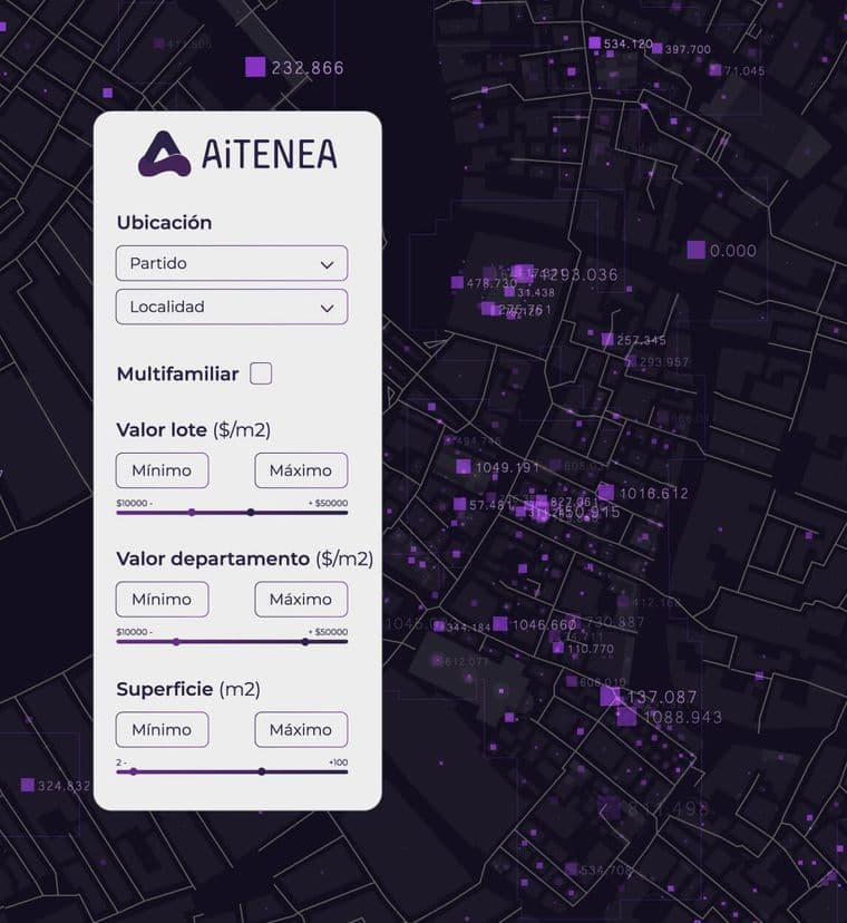
AiTENEA is a predictive analytics platform focused on the real estate sector. We were tasked with developing a comprehensive web solution that allows users to access accurate information about land and investment opportunities in real time, using geospatial technology, urban data, and prediction algorithms.

Location
Argentina
Project description
The platform developed by FriWi allows users to select a land parcel and visualize key data such as construction feasibility, zoning, regulatory restrictions, and appreciation projections. All of this is presented through an interactive map and an interface designed for industry professionals. The system uses an algorithm that analyzes geospatial, urban, and market variables to determine the potential of each lot. It integrates multiple layers of information that enable comparisons, automatic report generation, and facilitate technical and commercial decision-making.
Duration
1 Year

Impact
The solution positions AiTENEA as a key tool for real estate developers, architects, engineers, investment funds, governments, and even end users seeking to validate opportunities with real and updated data. With this development, AiTENEA democratizes access to technical land analysis, significantly reducing evaluation time and increasing planning accuracy.
Key results
01
Instant Plot Evaluation
Automatic and visual analysis of regulatory and valuation data.
02
Intuitive Interface with Interactive Map
Smooth navigation over urban areas with detailed lot information.
03
Decision-Making Support
Customizable reports and visualizations for B2B and B2C users.
04
Scalable Model
Architecture ready to integrate new data, features, and countries.
Client feedback
⭐⭐⭐⭐⭐
“I want to take a moment to thank and congratulate the Fiwii team. Not only did you achieve all the goals we set, but you also far exceeded them. I am truly very happy with the work you did. You are a spectacular group of people — committed, talented, and with a great attitude. The project we undertook was not simple: it was challenging, innovative, and required both a technical and creative approach. From day one, I felt I was working with a team that understands the vision, gets involved, and adds real value at every step. Today, I can confidently say that I have a strategic partner to continue projecting and growing. The best is yet to come!”


Technical details
The platform was developed as a scalable web solution with a Laravel backend, Next.js frontend, and Mapbox for geospatial visualization. It includes: - Authentication system and user profiles - Search engine and filters by technical and urban criteria - Parcel visualization on interactive map - Integration with geospatial PostgreSQL database - PDF report generation